

Western Massachusetts Day Trip (along the Mohawk Trail)

Welcome to Western Massachusetts Driving Along The Mohawk Trail Scenic Byway
Covering over 60 miles across Berkshire and Franklin counties in Western Massachusetts (MA), the Mohawk Trail (MA Routes 2 and 2A) is the first designated scenic road in New England. Along this “scenic byway”, you’ll find so many fun things to do and see including art museums, historic bridges and statues, small New England towns, rivers, waterfalls and state parks with beautiful nature landscapes and hiking trails.
With many notable attractions along the Mohawk Trail like the Bridge of Flowers in Shelburne Falls, Mount Greylock in Adams and the hairpin turn in the Taconic Mountains, we at MassDayTripping will share a few you might have passed by or aren’t familiar with to help you plan a fun day trip. Each site or place featured is directly off of or can be reached from the Mohawk Trail.
How to get to Western Massachusetts driving on the Mohawk Trail
Follow these general directions and plot your stops.
What to see along The Mohawk Trail
We’re going to do this day trip differently - as a series of stops - because there’s so many attractions you can visit by driving the Mohawk Trail.
Let’s start by visiting the oldest covered bridge in the Commonwealth: the Eunice Williams Covered Bridge in Greenfield, MA. First constructed in 1834, this historic bridge commemorates Eunice Williams who was the wife of the Reverend John Williams and killed in 1704 during the Queen Anne’s War in an attack on an English settlement. Learn more about the history of Eunice Williams Covered Bridge.
Tip: There is a small pull of where you can park a few steps from the bridge. When walking to the bridge, watch out for vehicles as there is only one lane for traffic.

Eunice Williams Covered Bridge Location
During our visit, as pictured above, we walked through the bridge to the other side to take in the natural scenery.
Next, we’ll head to Greenfield to visit Poet’s Seat Tower - an observation tower constructed in 1912 at the top of Rocky Mountain Park offering panoramic Pioneer Valley vistas. Located at 70 Mountain Road in Greenfield, a wooden tower was originally constructed at this site in 1879.
The current observation tower is made of sandstone, and there are several floors you can access via stairways. There are also stone benches at the lookout area, and you can visit the tower by driving up a paved, albeit bumpy road (the gate is open during the Spring through Fall and it’s about a one-third mile steady hike up).

Tip: When walking up inside to the observation tower, be sure to stop and see the stellar views.


Tip: After going to the top of the observation tower, you can hike on trails from the parking area and also find a bench to enjoy the vistas.
The next stop on our Mohawk Trail drive is the Montague Bookmill that is housed in a former grist (saw) mill originally established in 1834 (referred to as Alvah Stone). Located at 440 Greenfield Road, it is listed on the National Register of Historic Places. Today, the bookmill site houses the Sawmill River Arts gallery, a record store, two restaurants and the famed book store with a collection in the tens of thousands and piles that rise from the floor to the ceiling.

Tip: Before entering into the site, stop at the top of the Alvah Stone restaurant (pictured here) to get a sense of place. You can also take in the river by finding a table on the outdoor patio overlooking the falls.
With on-site parking, you can bring your family, and there are tables outside the restaurants you can sit at overlooking the waterfall. During our visit, we arrived too late to go inside the bookmill itself. Still, the scenery was totally worth it.

And there is a small path at the back of the parking lot to walk down to the river bank shore and see Saw Mill River waterfall. While very short, the path down is steep and, if it’s rained beforehand, you’ll need sturdy shoes.
And last, we’ll go to the French King Bridge that crosses the Connecticut River on the Mohawk Trail (MA 2) between the towns of Erving and Gill. There is parking on both sides of the French King Bridge, and there is a narrow sidewalk on the North side of the byway that you can walk to the center and look out over the Pioneer Valley horizon
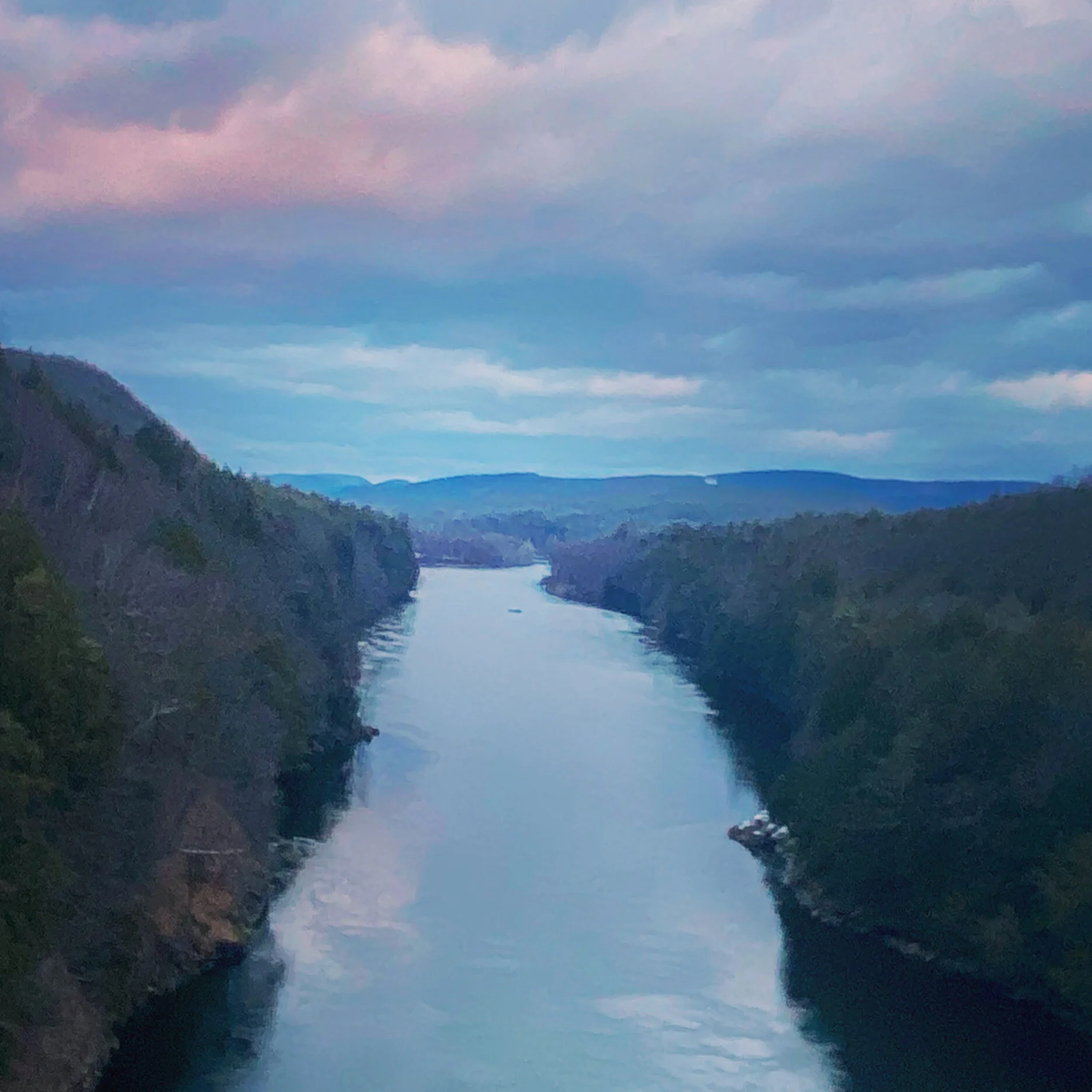
This steel arch bridge was open to traffic in 1932, stands 139 feet tall and is named for the French King Rock visible in the middle of the river. It is an awesome spot for drone/aerial and landscape photography and autumn fall foliage scenery.

Tip: Visit during sunset to capture dramatic scenes with clouds in the distance reflecting the tones of fading sunset light. The sunset sky is amazing across all seasons and in the spring and summer, you can see vivid blue hour tones.
What are your favorite Western Massachusetts attractions, state parks/scenic nature and towns to visit along the Mohawk Trail? Leave a comment below to help folks find fun, amazing things to see and do.